Cedar Creek
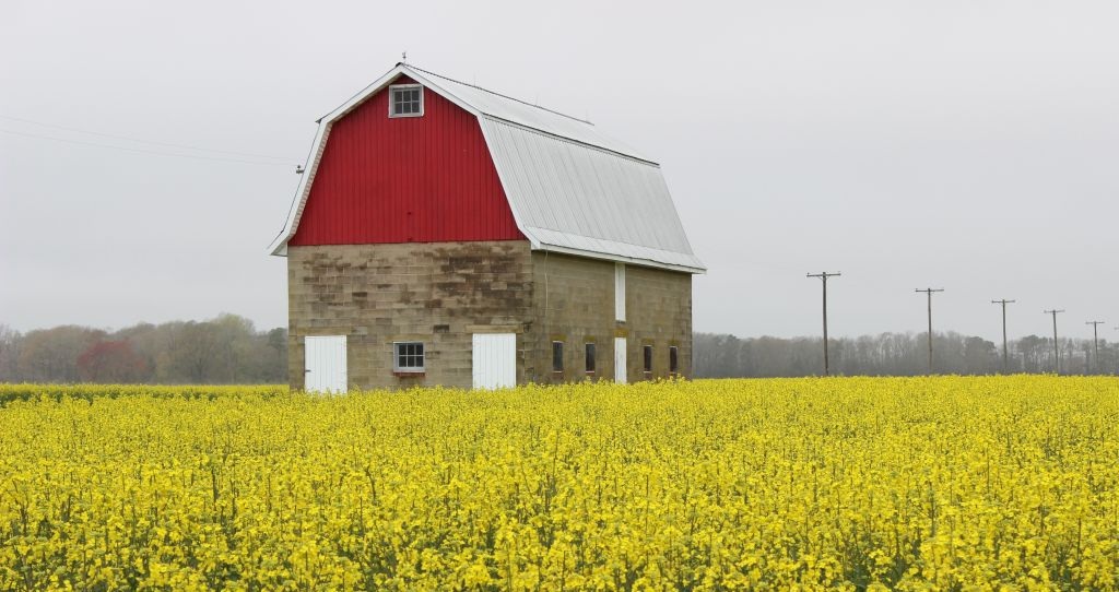
View of farm on Slaughter Neck Road
Photo credit: Joanne Taylor
Photo credit: Joanne Taylor
Other watersheds in the Delaware Bay and Estuary Basin
Square Miles: 52.2
Population*: 7,652
States: DE
Counties: DE: New Castle
Land use† in Cedar Creek
Appoquinimink River • Army Creek • Blackbird Creek • Broadkill River • C & D Canal East • Delaware Bay Drainage • Delaware River Drainage • Dragon Run Creek • Leipsic River • Little Creek • Mispillion River • Murderkill River • Red Lion Creek • Smyrna River • St. Jones River
Background
The Cedar Creek watershed is located in the eastern portion of Sussex County. The Cedar Creek is 15 miles in length. The major watercourse in this watershed is Cedar Creek. Major waterbodies within this watershed are Cubbage Pond, Clendaniel Pond, and Cedar Creek Mill Pond. Cedar Creek flows in a generally northeasterly direction into a stream called Slaughter Neck Ditch which subsequently flows northward and discharges at the mouth of Mispillion River.
The watershed is sparsely populated with no incorporated communities. Major land use in the area consists of agricultural lands and tidal marsh and swamp.
DNREC’s Wetland Monitoring and Assessment Program (WMAP) has been developing scientifically robust methods to monitor and evaluate wetlands in Delaware on a watershed basis. For more information on the health of the wetlands in this watershed, click here.
Water Quality
There are nutrient and bacteria TMDLs for the Cedar Creek watershed that require a 45% reduction in nitrogen loads, a 45% reduction in phosphorus loads, and a 95% reduction in bacteria loads.
The designated uses for the Cedar Creek include primary recreation, secondary recreation, fish, aquatic life and wildlife, industrial water supply, and agricultural water supply in freshwater segments. This watershed also is designated as waters of exceptional recreational or ecological significance for the marine waters segments.
This watershed has sites sampled for a consistent suite of environmental contaminants. These contaminants are broadly classified as Volatile Organic Compounds (VOCs), Semi-Volatile Organic Compounds (SVOCs), Pesticides, Polychlorinated Biphenyls (PCBs) and Metals as listed using USEPA and DNREC defined standards. When sites are adjacent to water bodies sediment samples are collected to assess potential impact from a site on the health of the waters. Learn more information specific to this watershed from the DNREC Advanced Facility Search Tool.
Plants and Wildlife
Delaware’s Department of Natural Resources and Environmental Control (DNREC), Division of Fish and Wildlife conducts on-going inventories of natural communities as well as rare and declining species, (e.g., state and globally-rare plants, birds, insects, mussels, reptiles, and amphibians). It maintains a database, both electronic and manual, of its findings throughout the state. Learn more about the wildlife and plant communities in this watershed from the DNREC Division of Fish and Wildlife Conservation Programs.
In addition, the Division of Fish and Wildlife, working with the University of Delaware’s Institute for Public Administration – Water Resources Center, maintains online databases about plants and plant communities in Delaware. Learn more about the plant communities in this watershed from the DNREC Division of Fish and Wildlife.
In addition, the Division of Fish and Wildlife, working with the University of Delaware’s Institute for Public Administration – Water Resources Center, maintains online databases about plants and plant communities in Delaware. Learn more about the plant communities in this watershed from the DNREC Division of Fish and Wildlife.
Further Resources
For more detailed information on this watershed, its water quality and resources, check out the following resources:
Delaware TMDLs
Delaware Watershed Plans
Delaware Whole Basin Reports
CCMP for the Delaware Estuary
Delaware TMDLs
Delaware Watershed Plans
Delaware Whole Basin Reports
CCMP for the Delaware Estuary
Cedar Creek
Cedar Creek quick stats
Square Miles: 52.2
Population*: 7,652
States: DE
Counties: DE: New Castle
*US Census Bureau, American Community Survey, 5-year estimates, 2019
Land use† in Cedar Creek
†Land use source: U.S. Geological Survey (USGS), 2024, Annual NLCD Collection 1 Science Products (ver. 1.1, June 2025): U.S. Geological Survey data release, https://doi.org/10.5066/P94UXNTS.